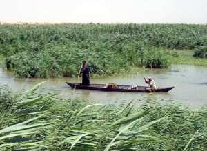
Until current research brought the prevailing opinions of leading archaeologists into question, it was widely believed that ancient cities in Mesopotamia sprang up alongside rivers. The theory was that river proximity allowed ancient city inhabitants to irrigate the surrounding desert, thus making the land arable. It was thought that cities such as Ur, which is believed to have originated near the mouth of the Euphrates River sometime in the 25th century B.C., were able to sustain themselves because of their ability to irrigate the surrounding areas with river water.
New Ideas
Interestingly, Dr. Jennifer Pournelle of the University of South Carolina has been pursuing a different explanation for the connection between water and ancient cities. She posits that early urban areas in Iraq were sustainable because of their location in marshes, not beside rivers.
 This might seem like a technicality, but it’s an insightful observation that’s changing the way archaeologists perceive the origins of ancient urban areas. If Iraq’s ancient cities thrived in lowland marshes fed by rivers, their inhabitants used resources in different ways than they would have if they had relied on irrigation to provide them with a way to grow food from the land. Pournelle and her research team have reason to believe that Iraq’s ancient southern cities were successful because of their location in marshes that easily sustained rice crops.
Digging Deeper
Together with an archaeologist from Pennsylvania and a geologist from Missouri, the South Carolinian research assistant combined excavation records, archaeological site maps, and aerial and satellite images to recreate an accurate representation of the ancient environment in southern Iraq. Pournelle’s work differs from previous efforts to study the ancient urban characteristics of this area in several ways. First, her efforts are the most recent after a short burst of interest from 1900 to 1950. Additionally, her work includes a comprehensive study of flora and fauna where previous archaeologists focused mainly on objects and architecture. And with recent developments in technology, she’s been able to combine research strategies to reveal a more holistic view of the ancient cities that thrived in the marshes of southern Iraq.
According to Pournelle’s work, marsh resources, wildlife, and environmental conditions were vital to the process of sustaining cities. These same conditions are also integral to our understanding of these civilizations and how they were able to function. In an interview published in a physorg.com article, Pournelle confidently states that the key to these cities’ long-term survival, as compared with cities in other environments, was the wetlands. Marsh areas have their own distinct ecology, different from riverside environments, and those unique characteristics were vitally important to some of the oldest cities in the world.
Iraq and South Carolina
Connecting past and present, Pournelle points out some of the commonalities between ancient (and modern) Iraq and the current problems being faced in South Carolina. She thinks that the two regions, which have similar environmental characteristics, can inform us about important modern-day issues. Both Iraq and South Carolina are working to overcome problems with water resource management, pollution control, coastal and port development, and environmental management.
Pournelle plans to continue her research in Iraq, hoping to uncover ancient sustainability strategies that might have parallel applications in her own century and state.
Author
Maria Rainier is a freelance writer and blog junkie. She is currently a resident blogger at First in Education where she writes about education, online degrees, and what it takes to succeed as a student taking a bachelors degree program remotely from home. In her spare time, she enjoys square-foot gardening, swimming, and avoiding her laptop.